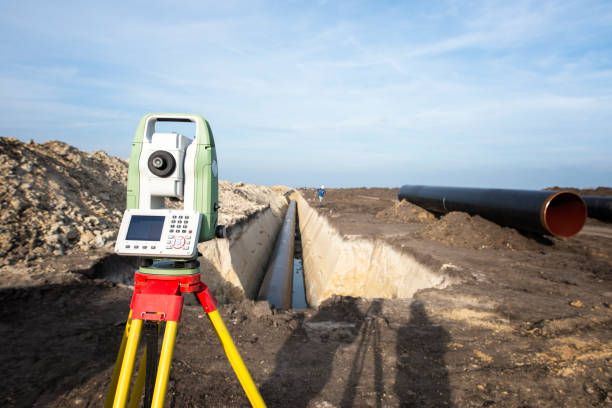
What Is a Topographic Survey?
A topographic survey is a detailed study of a piece of land that identifies both natural and man-made features. It records elevation levels, contours, trees, roads, drainage systems, buildings, utilities, and other important site characteristics.
Before planning any development project, engineers, architects, and developers need a clear understanding of the site's physical conditions. Topographic surveys provide the essential data required for accurate design and project planning.

Why Topographic Surveys Matter
Every development project faces unique site conditions. Elevation changes, slopes, drainage patterns, and existing structures can significantly influence design decisions and construction costs.
By conducting a topographic survey at the early stages of a project, developers can identify potential challenges before construction begins, reducing costly modifications and delays.
Information Captured During a Survey
Modern survey equipment collects detailed site information that helps project teams make informed decisions throughout the development process.
Typical Topographic Survey Data Captured
- Ground elevations and contour levels
- Property boundaries and site dimensions
- Roads, pathways, and access points
- Existing buildings and structures
- Drainage systems and water flow patterns
- Trees, vegetation, and natural features
- Utility lines and infrastructure details
Benefits for Development Projects
Accurate topographic data helps architects create practical designs, allows engineers to optimize grading plans, and assists project managers in estimating costs more accurately.
It also helps ensure compliance with local regulations while improving overall project efficiency and reducing unforeseen site-related issues.
Modern Technology in Topographic Surveys
Today's surveyors use advanced technologies such as Total Stations, GPS systems, drones, and digital mapping software to collect highly accurate terrain information quickly and efficiently.
These technologies improve precision, reduce fieldwork time, and provide detailed digital models that support better planning and decision-making.
Conclusion
Topographic surveys play a crucial role in the success of development projects. By providing accurate information about terrain, elevations, and existing site conditions, they help developers, engineers, and architects make informed decisions from the earliest planning stages.
Investing in a professional topographic survey helps reduce project risks, improve design accuracy, and ensure smoother construction execution from start to finish.